With the weather finally cooling off a little in New York it was time last weekend to get out of the city and into the countryside. I’d been wanting to get back to the beautiful Hudson Valley for some time so on Sunday morning we got an early rise to head to Breakneck Ridge.
Breakneck Ridge is a hugely popular hiking spot about 50 miles north of New York City. Located in the Hudson Highlands it offers some breathtaking views, lush woodland and, even better, is easily accessible by train. There is a relatively frequent service to Cold Spring, 3 miles or so south of the Breakneck Ridge trail head, but Breakneck Ridge Station itself has trains stopping from Grand Central a couple of times on a Sunday morning. We got the later of these two, the 8:50am, which arrived a little after 10.
 The popularity of this area was very apparent to us as a huge stream of hikers left the train at the tiny platform (just a couple of steps really, a platform is giving it too much standing). A quarter of a mile away the trail started and we were greeted almost immediately by the first of several steep climbs over boulders. This isn’t quite rock climbing territory, but you wouldn’t want to try doing this in flip flops or soon after a rain shower. I was certainly on all fours several times.
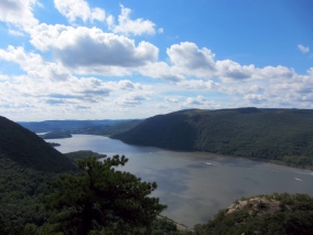
After each of the 5 or so climbs going up the ridge you are greeted with some fabulous views of the Hudson. Once at the top you’ve climbed 1200 feet or so in only 3/4 of a mile, so this is definitely up there in ‘strenuous’ territory, for me at least.
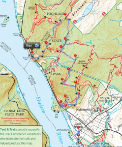
There are various options you have once at the top to continue your hike. Most people will take a circular route to get back to their car, but we knew we wanted to end up at Cold Spring where the return train service to Grand Central is much more frequent (about once an hour) than trying to get a train from the Breakneck Ridge stop. Knowing this we planned a route through the woods that took in another climb (part way up Mt Taurus, giving us great views of the ridge we’d just climbed) before putting us back in civilisation a quarter of a mile north of Cold Spring (click on the attached picture for the route.)
We were walking about 5 hours, with a couple of stops for food. Once back in Cold Spring we enjoyed a well earned beer at McGuires, and then an ice cream at Moo Moo’s before getting the train back to Grand Central. All in all a wonderful day out.
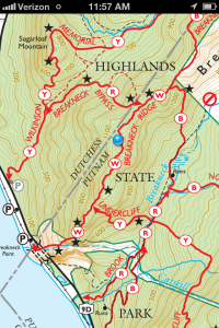
 Avenza PDF Maps is (unsurprisingly) a map application for iOS. The key though is that it doesn’t come with it’s own maps – you download apps using its inbuilt store. The New York-New Jersey Trail Conference have a great selection of hiking maps near me, and some of these are available through the Avenza app. I bought the ‘East Hudson (North)’ map for my hike at Breakneck Ridge.
